07/02/2024.
Many of you are probably away that Wright Square is another of the Newark Earthwords that are worth visiting. In fact, if you go on Jeff Gill's "Remnants" tour (usually conducted around the time of Octagon Open Houses), he will stop there. There's not much left, since first the Ohio and Erie Canal cut through it, then the Ohio Electric Railroad railroad, and finally, they ripped it up pretty thoroughly when they made Rte. 79 a four-lane highway. But there is still a remnant. This remnant is useful when using various historical maps to reconcile the overall locations of the mound complex.
But there's an issue. Wright Square is reconstructed. Was it put in the "wright" place?
Here's what generates my concern. With LiDAR these days, we can see exactly where the remnant mounds are. So, let's see what we can get out of that.
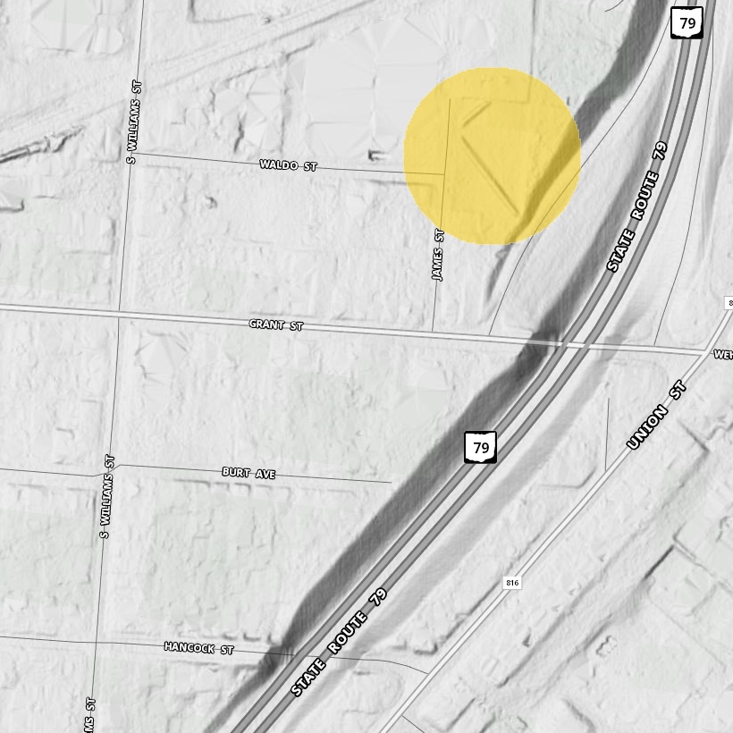
Here you can see the LiDAR image showing the exact location of the remnant walls, nestled between Grant, Williams, Rte. 79, and the railroad (not shown) near downtown Newark.
The "gold standard" survey of Wright Square was done in the 1880s by James Middleton of the Smithsonian Burean of Ethnology. He did surveys of many of the other earthworks in Chillicothe and Newark. According to him, the northeastern wall has a bearing of N. 47° 53' W.
Such a line is easy to overlay onto the LiDAR image.
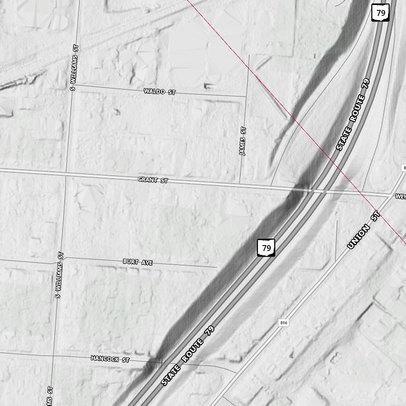
Huh. It's off by about 4.3°.
we can also place Middleton's drawing of his results over the LiDAR image. From other records we know which walls those remnant walls were.
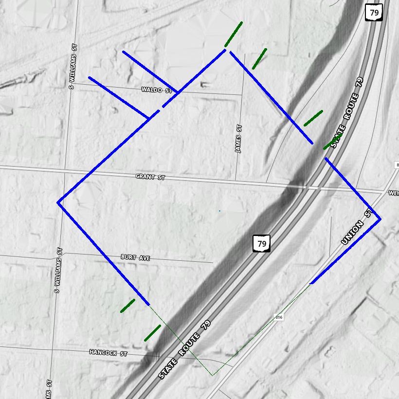
But if you look fairly closely at this picture, you might notice something. The streets themselves don't seem to run north/south. That's fairly common in Newark—the grid systems in various areas are skewed. (Downtown Newark is skewed by about 20°, which, as far as I can tell, means it aligned pretty close to where magnetic north was back in the early 1800s).
So, what if somebody made the mistake of thinking that the street grid was aligned with true north? We can test that by rotating the grid and seeing what N. 47° 53' W does.
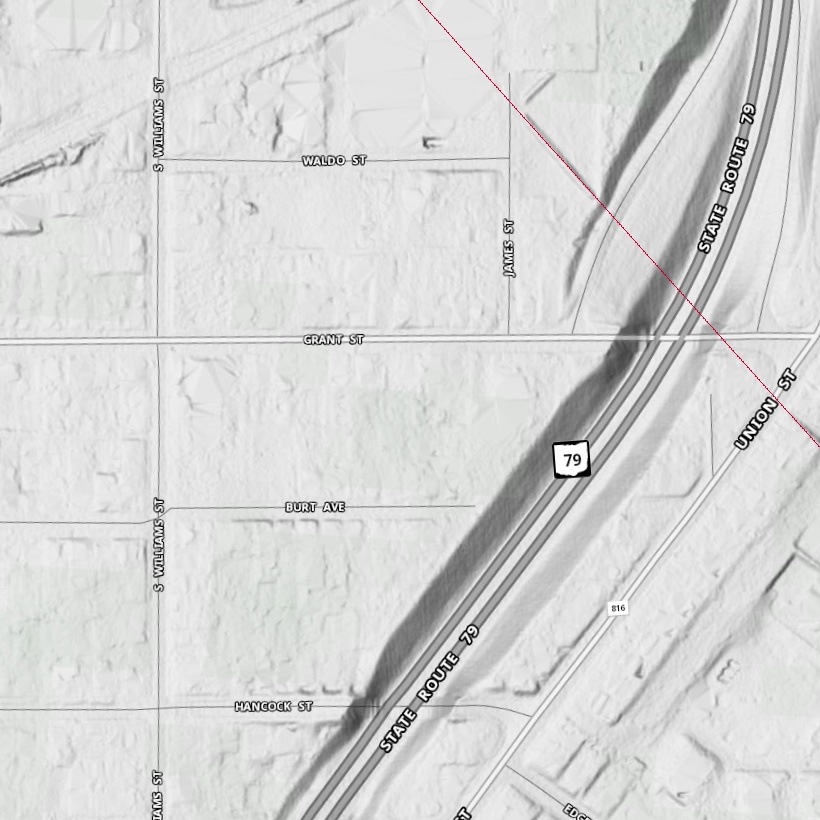
That looks pretty conclusive, don't you think?
But we can also ask other questions. The CCC back in the 1930s did a lot of reconstructive or regenerative work on various mounds. But, more importantly, when Rte. 79 was put in, archaeologists had to scamble (as, unfortunately, they so often have to do) to preserve whatever knowledge they could from a site that was about to be forever altered (i.e., destroyed).
Brad Lepper and Richard Yerkes wrote a paper in 1997 describing the efforts done by Everett Hale in 1977-80 (Lepper 1997).
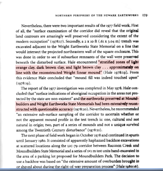
While Hale did find "stratified zones of light orange clay, dark brown clay, and light brown clay . . . approximately on line with the reconstructed Wright linear mound", he also concluded that (quoting Lepper and Yerkes) "the earthworks preserved at . . . Wright Earthworks had been extensively reconstructed with questionable accuracy." Lepper and Yerkes took exception to that latter characterization and detailed why.
I think what we can conclude, though, is that, in the main, the remnants are reasonably placed, but not so accurate as to preclude the sort of mistake I am talking about.
This picture shows both the two possible orientations of Wright Square.
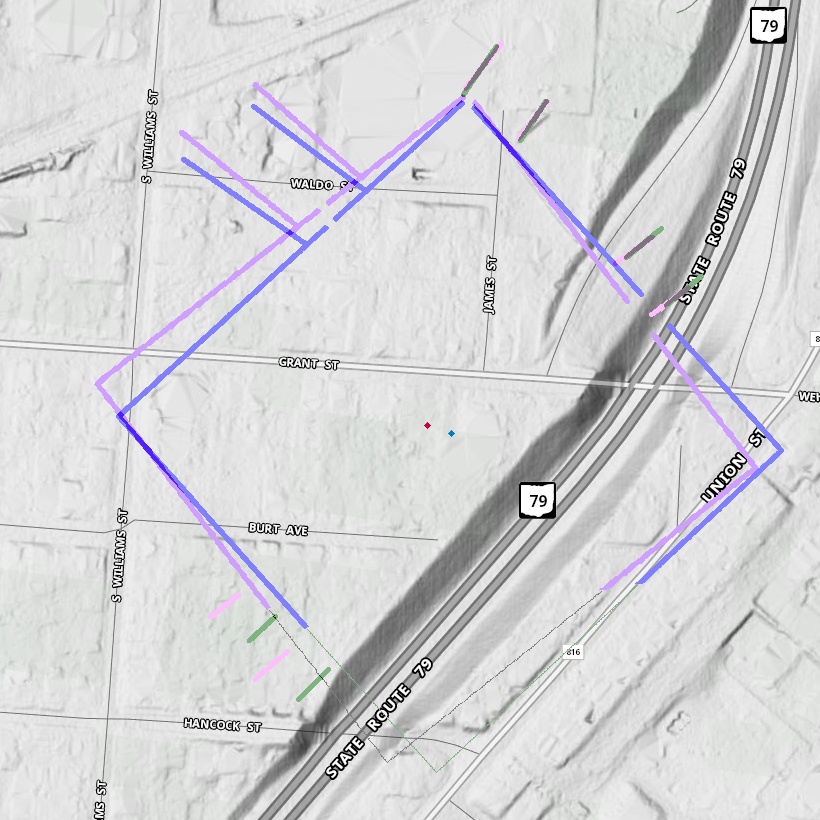
The pinkish one shows Wright Square assuming that the reconstructed mounds are accurate, while the bluish one shows Wright Square assuming that James Middleton's survey, the "gold standard", was correct.
Why does this matter? Here's why it matters to me.
The Indigenous Peoples of the Hopewell Culture are well-known for their geometrical, astronomical, and surveying skills as applied to design of their mounds. They are less-well known, though, for their ability to use those skills over an entire landscape. One example was noted by Hively & Horn in their 1982 paper: The distance from the center of Observatory Mound to the center of the Great Circle is very close to six times the radius of Observatory Circle. And the distance from the center of the Octagon to the center of Wright Square is much the same. But for that latter measurement, you really need to accurately know just where the center of Wright Square is.
The two different possibilities are also shown on this image. The one using true north is in aqua, while the one using the street-based pseudo-north is in red. That covers a difference of about 50 feet. The one using true north gets a lot closer to matching the Observatory Circle/Great Circle distance.
It also matters for other endeavors. Over the past two years Ball State University had grant that, among other things, used computer modeling to try to reconcile the various maps of the Newark Earthworks from over the past 200 years, the Virtual World Heritage Ohio Newark Consensus Map. In the interest of getting it as accurate a possible, they were able to include the Gill Notch, the entryway point of the eastern corridor discovered by Jeff Gill. Doing so provided new insight into the overall architecture.
Yet, somehow they unfortunately missed orienting Wright Square properly. (I'd mentioned that issue to some folks back in 2013.) Anyways, here's how the new map looks, with the blue line showing the Middleton line.
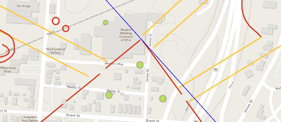
Getting this right affects various hilltop claims regarding watching sun- and moon-rises/sets.
Reference:
Lepper 1997
Hopewellian Occupations at the Northern Periphery of the Newark Earthworks - The Newark Expressway Sites Revisted, by Bradley T. Lepper and Richard W. Yerkes. In Ohio Hopewell Community Organization (1997), ed. William Dancy and Paul Pacheco. Chapter 7.