10/11/2023.
I missed posting about the boreal lunistice on the 5th. Needless to say, the (near-midnight) moonrise was getting really close to aligning with the axis of the Octagon. Instead, what I'd like to do here is talk about the important "alignment" connecting the earthworks at Chillicothe with the earthworks at Newark. While the Great Hopewell Road is part of that, I think I can add an additional perspective on a wider view of the importance of the entire area.
It is my thought that the long-term indigenous inhabitants of the region (including at a minimum those called the Adena and Hopewell cultures) would have been intimately familiar with the environment of the entire area. This was their home and their life, after all. They would pay attention to, and know more, about way more than just the moon and stars. They would be immersed in the biology, and even the landforms and geology that they depended on to stay alive, more than we do these days, where we can just drive around without thinking about such things.
What I think they would have seen is the deeper connection, a special connection, a spiritual connection, a sacred connection, between Chillicothe and Newark, and the route of the Great Hopewell Road is just a minor manifestation of that. I strongly suspect they knew that they lived in what I will call "The Land of Wrong-Way Waters" which was special to them. And maybe should be special to us.
Let me start with what looks like a diversion by looking at the area near Flint Ridge with this picture of the topography to its north and west.
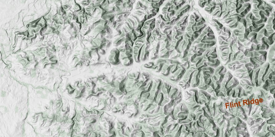
Just look at that and think about how the creeks in the area flow. What we expect is that they start on higher ground and head downhill, with their valleys widening as they go.
So, see if this picture of my first thoughts matches what you thought.
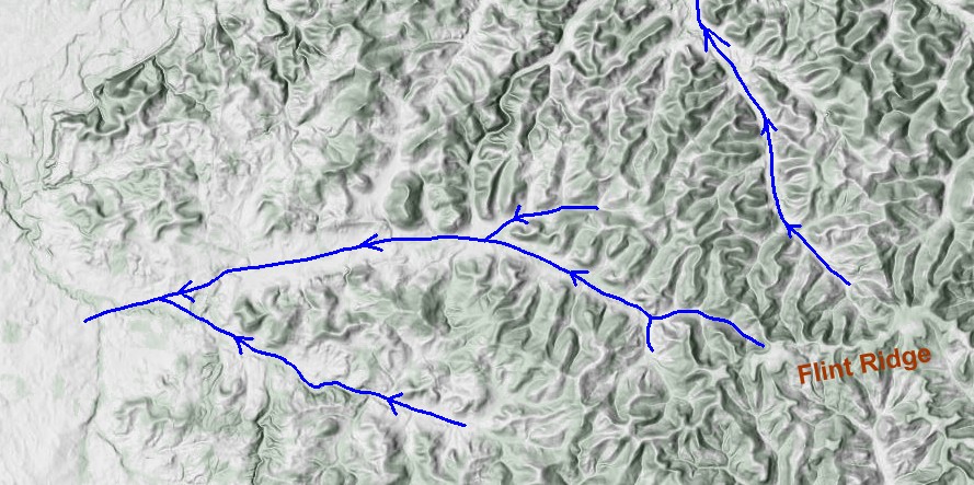
No surprises here, I hope. Now look at what the creeks actually do.
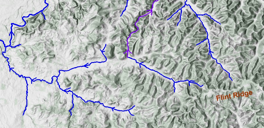
I hope you are surprised. The purple is Claylick Creek, just south of the Licking River, which it flows into. The unattached part to the west is Swamp Run, which joins Hog Creek to create Dutch Fork, which flows into the South Branch of the Licking. What's going on?
Let's look at another example.
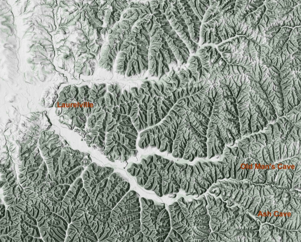
Now we are down in Hocking Hills. Again, look at the terrain and figure out which way the creeks flow.
Here is my naive stab at it.
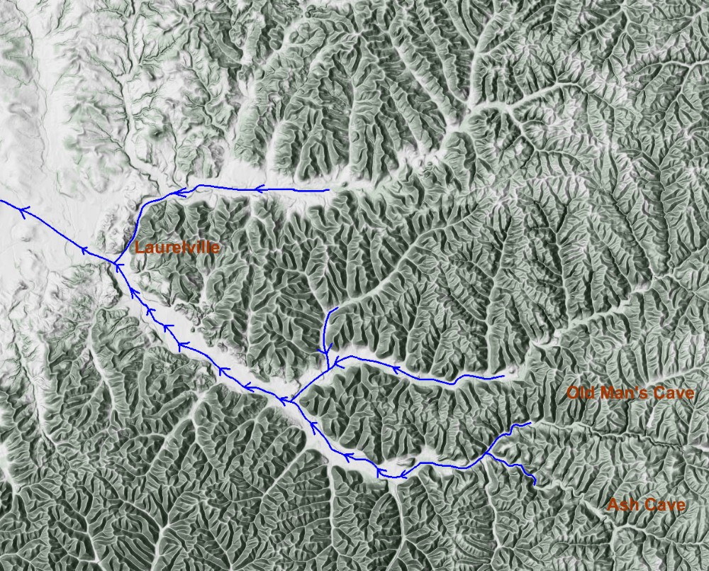
That looks pretty reasonable, right? This is what actually happens.
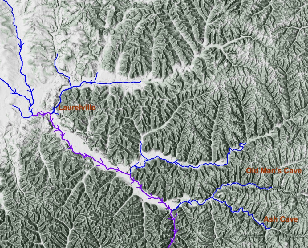
That purple is Salt Creek, the one that runs south next to the Tarlton Cross Mound. So maybe you are getting a hint of why I call these Wrong-Way Waters. As you can see, it heads what looks to be upstream until it hits Queer Creek coming from Cedar Falls in Hocking Hills, and then makes a sharp turn to the south to head through a gorge.
That "Wrong-Way Waters" situation is not unique to Claylick Creek and Hocking Hills. In fact, such peculiarities are scattered in the hills just offset from the axis between Newark and Chillicothe. This picture shows that there is a huge number of them. (Frolking 2006).
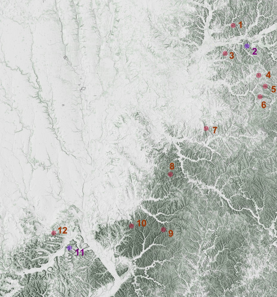
We are truly living in the Land of Wrong-Way Waters. Each red dot shows an area where a creek or river is NOT doing what one expects. It either runs what appears to be the wrong way, or it suddenly takes a sharp turn and heads into a gorge of some sort. Here's the list of them:
- Rocky Fork
- Blackhand Gorge (Licking River)
- Claylick Creek
- Kent Run (North)
- Kent Run (South)
- Jonathan Creek (Glenford Fort)
- Little Rush Creek
- Clear Creek (Clear Creek Metro Park)
- Salt Creek/Queer Creek (Hocking Hills)
- Walnut Creek (Tar Hollow State Forest)
- Paint Creek Gorge
- North Fork Paint Creek
But now let me switch gears for a moment and talk about the Great Hopewell Road.
Here's the Great Hopewell Road, running between Chillicothe and Newark.
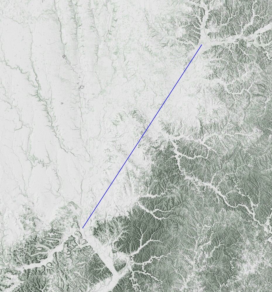
Newark is on the northeast end and Chillicothe is on the southwest end. I hope you can see just how similar the two areas look, topographically, with decent rivers (Licking River and Paint Creek) sitting on the edge of Appalachia.
One of the important features of the Great Hopewell Road has been identified by William Romain (Romain 2015), who has noted that the Great Hopewell Road lines up with the Milky Way (considered a "Path of Souls") for the summer solstice. In addition, a line perpendicular to it hits either the summer solstice sunset or the winter solstice sunrise. The indigenous peoples of the area must have noted this physical relationship and attributed a special or sacred purpose to this connection between Chillicothe and Newark.
Brad Lepper likes pointing out a Graphical Information System analysis done by Tim Price (Price 2004), which looked at "suitability" and "cost" of that route. It always struck me a bit odd that a straight line between those two important points seemed to optimize suitability and cost. After all, once you determine that Chillicothe and Newark are important, the direct path between them has been determined by that, not other criteria. Is it mere coincidence that the path is optimized? Or is there something special going on, something special that was recognized by the indigenous peoples of the area which adds to Chillicothe and Newark being such special places? (Of course, my answer to that is "yes!")
In the valley at the north end of the Great Hopewell Road, we have a major Wrong-Way Water anomaly (along with major earthworks): the Licking River.
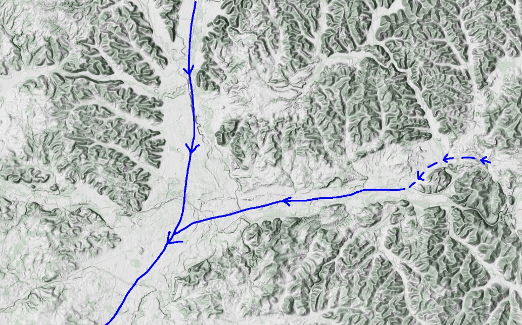
If you weren't familiar with the area, and if Blackhand Gorge were not there, I suspect you'd think that the Licking River should be going the other direction, from east to west and opening into the valley occupied by Newark. But it's not.
This is what it is really doing.
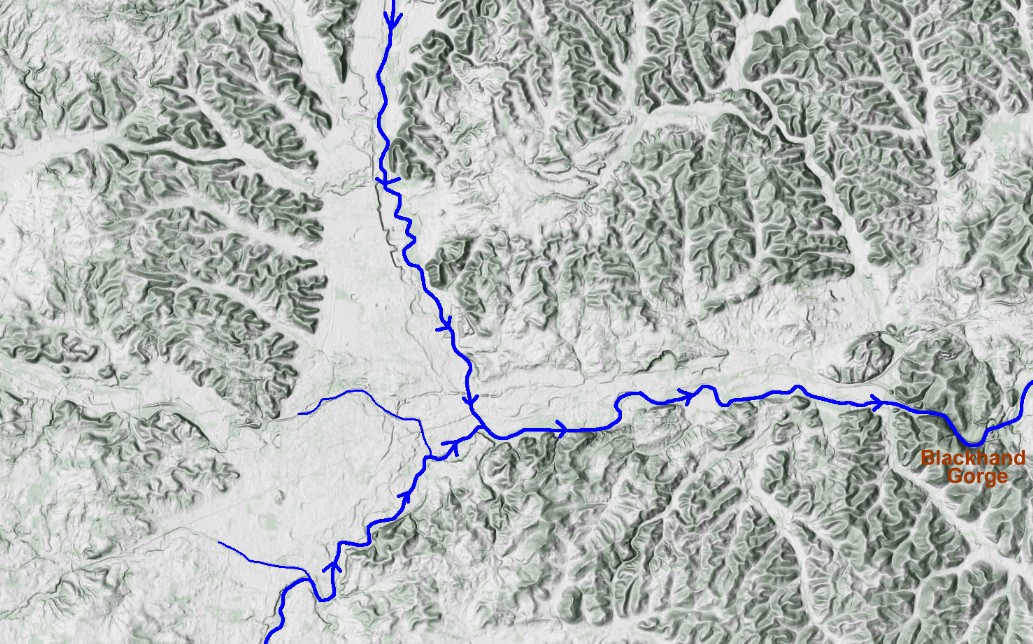
And we're not talking about a small creek here, but a major waterway. Let me repeat myself—it looks like the Licking River is running the Wrong Way.
In the valley at the south end of the Great Hopewell Road, we have another major Wrong-Way Water anomaly (along with major earthworks): Paint Creek.
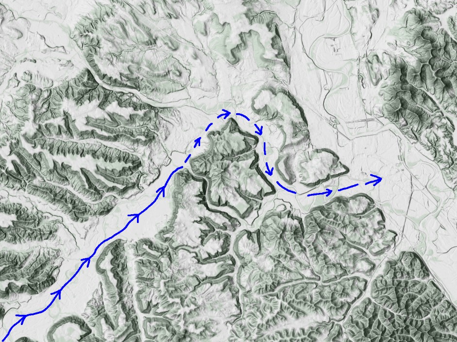
It looks like it ought to join the Scioto in a fairly straightforward manner. But it doesn't.
This is what it really does.
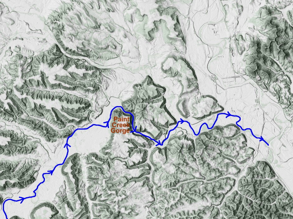
While it doesn't look like it is running the wrong direction, what it does do is suddenly take a right turn into Paint Creek Gorge.
And Paint Creek, while called a "creek", is just as large a waterway as the Licking River. Its flow of water is quite comparable to the Licking. Both of them average about 300-400 cubic feet per second of water flow over a year.
Here I have combined the Great Hopewell Road with the locations of the "Wrong-Way Waters".
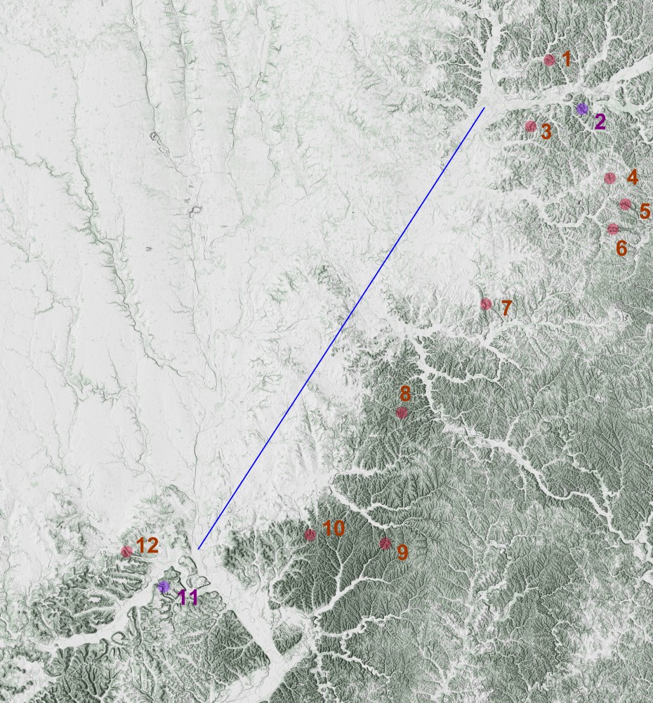
What we see, in addition to the Milky Way Path of Souls and the optimal pathway between two similar valleys, is a connection between these major Wrong-Way Waterways that includes a collection of minor Wrong-Way Waterways.
So, what's going on here? Why is it like this, that the indigenous peoples would almost assuredely note all of this and see just how special, just how sacred, this landscape was?
It's the glaciers. This axis sits along the edge of the advance of glaciers. The Illinoian glaciation made it this far south about 200,000 to 300,000 years ago, and the Wisconsinan glaciation made it this far about 21,000 years ago (though the Wisconsinan didn't get quite as far south as the Illinoian).
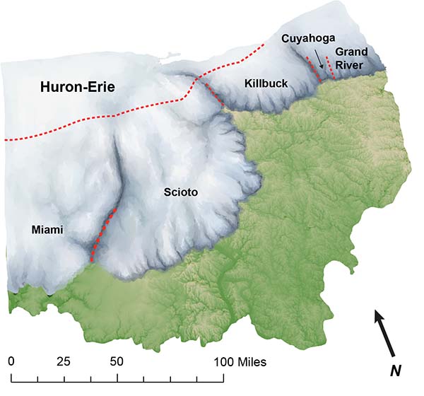
Illustration by Madison Perry (Norris 2019).
What happened is that the edge of the glaciers blocked the original outflows of the waterways that are now running the "wrong way". They would have formed glacial lakes which would have risen higher and higher until they overtopped a low point along a ridge and then carved a gorge as the waters escaped out their newly carved back door. Then, as the glaciers receded, the new paths had already been established. Hence, Paint Creek Gorge. Hence, Blackhand Gorge. Hence Claylick Gorge. Hence Salt Creek Gorge. Etc..
Although it looks like the creeks and rivers might be running backwards, they aren't. The area where the glaciers were (including Newark) and the whole line along the Great Hopewell Road had their elevations raised by all the glacial till (sediments) pushed there by the glaciers. This is true of all of Ohio northwest of the glacial margin.
This also accounts for the optimizations of the Great Hopewell Road. All that till forms a (mostly, kind-of) uniform surface for the road to lie upon. I would also note that Fort Ancient and the earthworks to the west also lie along the margin of the edge of where the glaciers reached. The Adena-Hopewell cultures are most likely a product (in part) of the glacial margin.
At this point I'm going to diverge into, following Wegner's example in describing his theory of continental drift "geopoetry", archaeopoetry. There is little to no evidence to support this, but it is cool to think about:
These 21,000 year old footprints found at White Sands have been in the news lately (Bennett 2020).
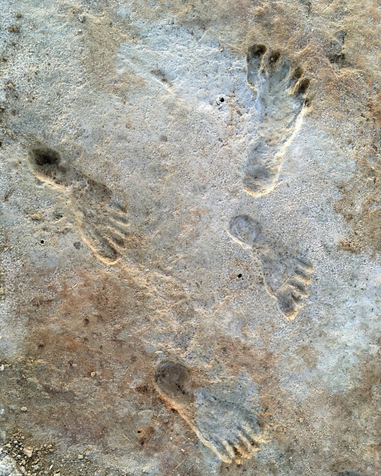
They tell us that it is entirely possible that humans were around when Blackhand Gorge was carved, since 21,000 years ago is when the (Wisconsinan) glaciers in Ohio reached their maximum extent and the Glacial Lake Licking overtopped the low ridge there. They would have seen the waterfall and watched the blackhand sandstone being cut back in a kind of mini-Niagara Falls.
The area at and east of Blackhand Gorge was beyond the glaciated region, so its environment would most likely have been an open spruce woodland with some tundra, so it was not impossible for humans to be there.
I wonder how long the lore associated with witnessing such an event (assuming it was seen) might have influenced further generations, who would continue to acknowledge what a special place this was.
References:
Bennett 2020
Walking in mud: Remarkable Pleistocene human trackways from White Sands National Park (New Mexico), by Matthew R. Bennett, et al.. Quaternary Science Reviews, Volume 249, 1 December 2020, 106610.
Frolking 2006
Glacial Lake Licking: Late-Glacial Drainage Diversion and the Formatio nof Black Hand Gorge, Licking County, Ohio, by Tod A. Frolking and Matthew A. Pachell. Ohio Journal of Science 106 (3):103-111, 2006.
Norris 2019
Ice Age In Ohio—Evidence Below Our Feet, by Tyler A. Norris. GeoFacts No. 33, October 2019. Ohio Geological Survey, Ohio Department of Natural Resources.
Price 2004
The Great Hopewell Road: GIS Solutions towards Pathway Discovery, by Timothy A. Price. Master's Thesis, Ohio State University, November 2004.
Romain 2015.
Adena-Hopewell Earthworks and the Milky Way Path of Souls, by William F. Romain. In Tracing the Relational: The Archaeology of Worlds, Spirits, and Temporalities, ed. Meghan E. Buchanan and B. Jacon Skousen, pp. 54-82. University of Utah Press, Salt Lake City (2015).